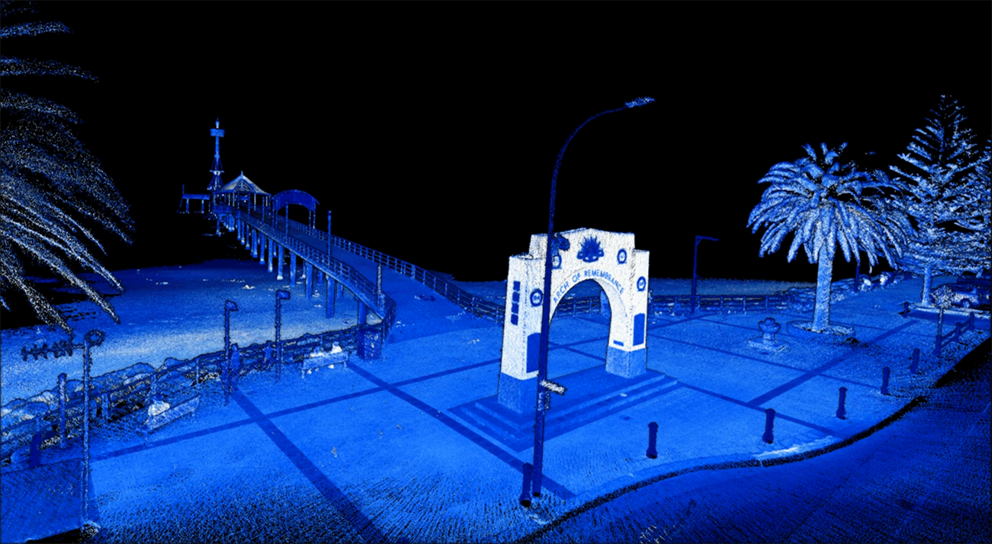
3D Laser Scanning
Aerial Laser Scanning
Terrestrial Laser Scanning
Internal Laser Scanning
Professional aerial 3D survey and laser scanning services using high-resolution LiDAR sensor technologies.
Azure employs high-resolution laser scanning sensors to deliver precision 3D digitisation services for industrial, infrastructure, and geotechnical applications. Our advanced laser scanners capture detailed and accurate 3D data of internal and external structures, providing comprehensive dimensional information for asset management, as-built review, reengineering, decommissioning, and building information modelling (BIM) projects.
Case Study
3D Laser Scanning
Jetty Digitisation

Aerial Laser Scanning
Azure are experts in drone laser scanning services utilising our market-leading drone, photography, and survey technologies.
The use of drones allows for safe, efficient, and accurate survey of hard-to-reach and hazardous areas, minimising the need for costly and time-consuming manual measurements.
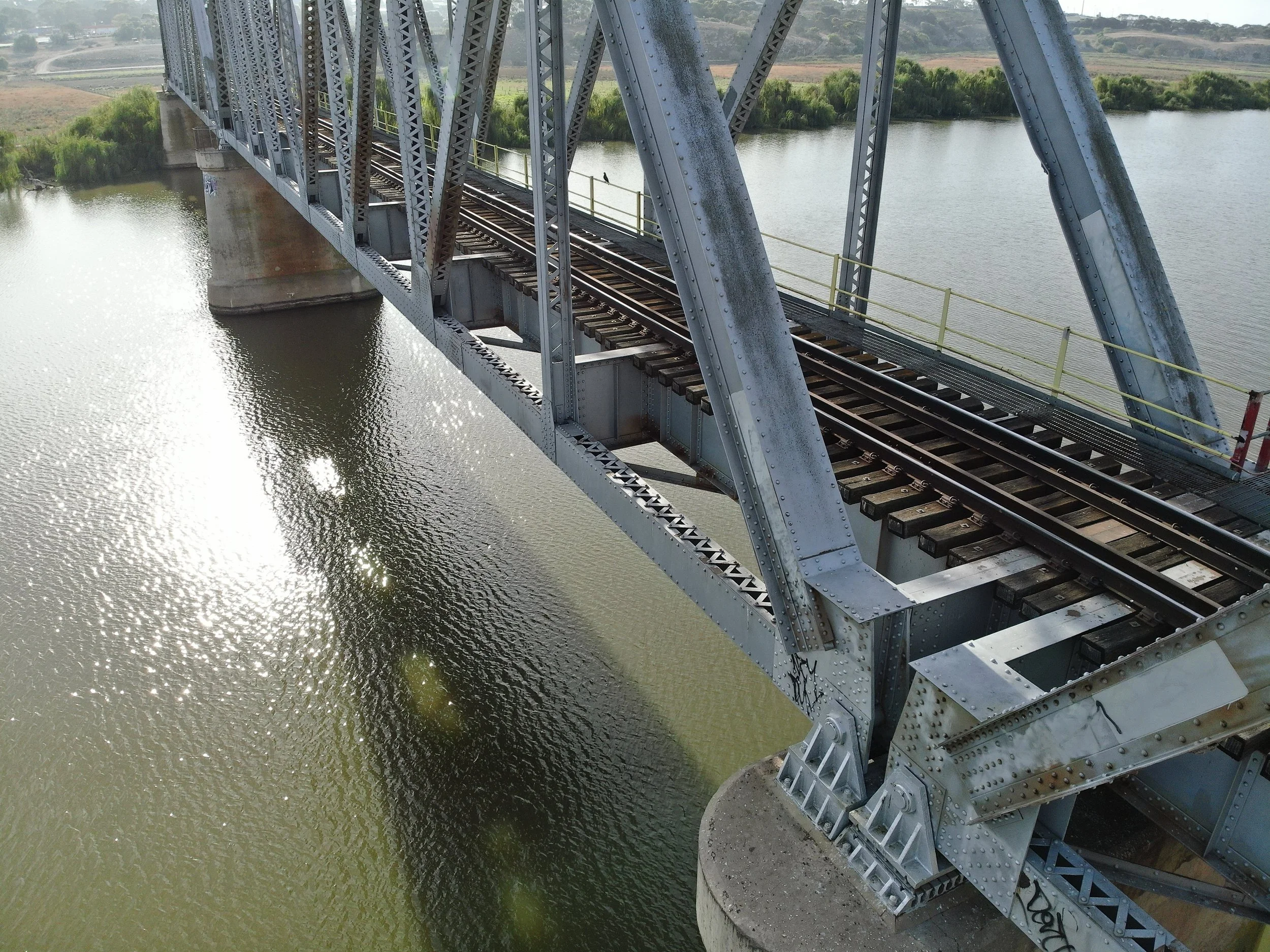
Our team have successfully carried out drone laser scanning on mine infrastructure, refineries, power stations, bridges, jetties, bulk export loaders, and power networks.

Terrestrial Laser Scanning
Our experienced team generate detailed and precise terrestrial LiDAR models using cutting-edge SLAM LiDAR scanners to create precision point cloud models for engineers to use for as built assessment, reengineering and decommissioning planning, and asset management projects.

Internal Laser Scanning
Azure specialises in complex internal laser scanning using our in-house Elios 3 RPAS and experienced pilot team.
Increase safety, reduce downtime and laser scanning costs, and improve asset information quality all while removing the need for workers to enter dangerous confined environments with our collision resistant confined space robotics and skilled remote pilots.
Our team have successfully carried out laser scanning missions with the Elios 3 in confined spaces such as storage tanks, culverts, bridges, grain silos, boilers, chimneys, piperacks, and underground mines.
Project Examples
-
![]()
Plant Structural Inspection
Drone structural inspections of high-up, hard-to-reach, and hazardous areas of processing, refining, and storage facilities.
-
![]()
Tank and Silo Inspections
Remote confined space entry of tanks and bulk storage silos including visual inspection, LiDAR scanning, and ultrasonic thickness measurement.
-
![drone-culvert-inspection]()
Culvert and Tunnel Inspections
Close visual inspection and LiDAR survey of confined access culvert, drain, and tunnel structures.
-
![]()
Bridge Inspections
Internal and external inspection and measurement of bridge viaducts, girders, trusses, piers, footings, and bearings.
-
![]()
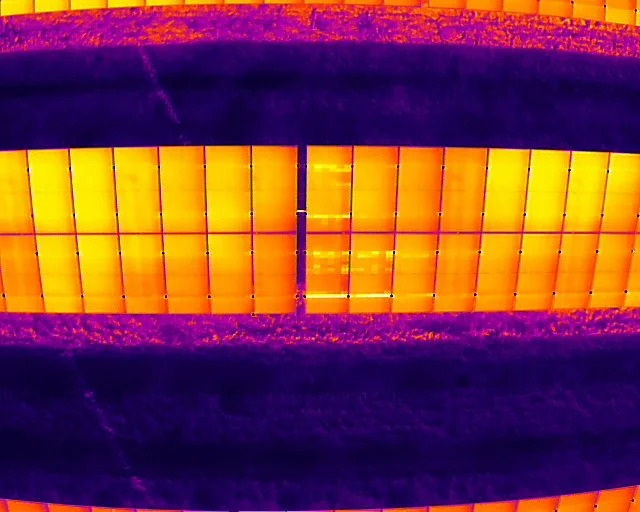
Solar Farm Inspections
Thermographic commissioning and maintenance assessment of solar farms and associated electrical infrastructure.
-
![]()
Wind Turbine Inspections
Ultra high-resolution close visual inspection of wind turbine blade integrity and coating condition.
-
![]()
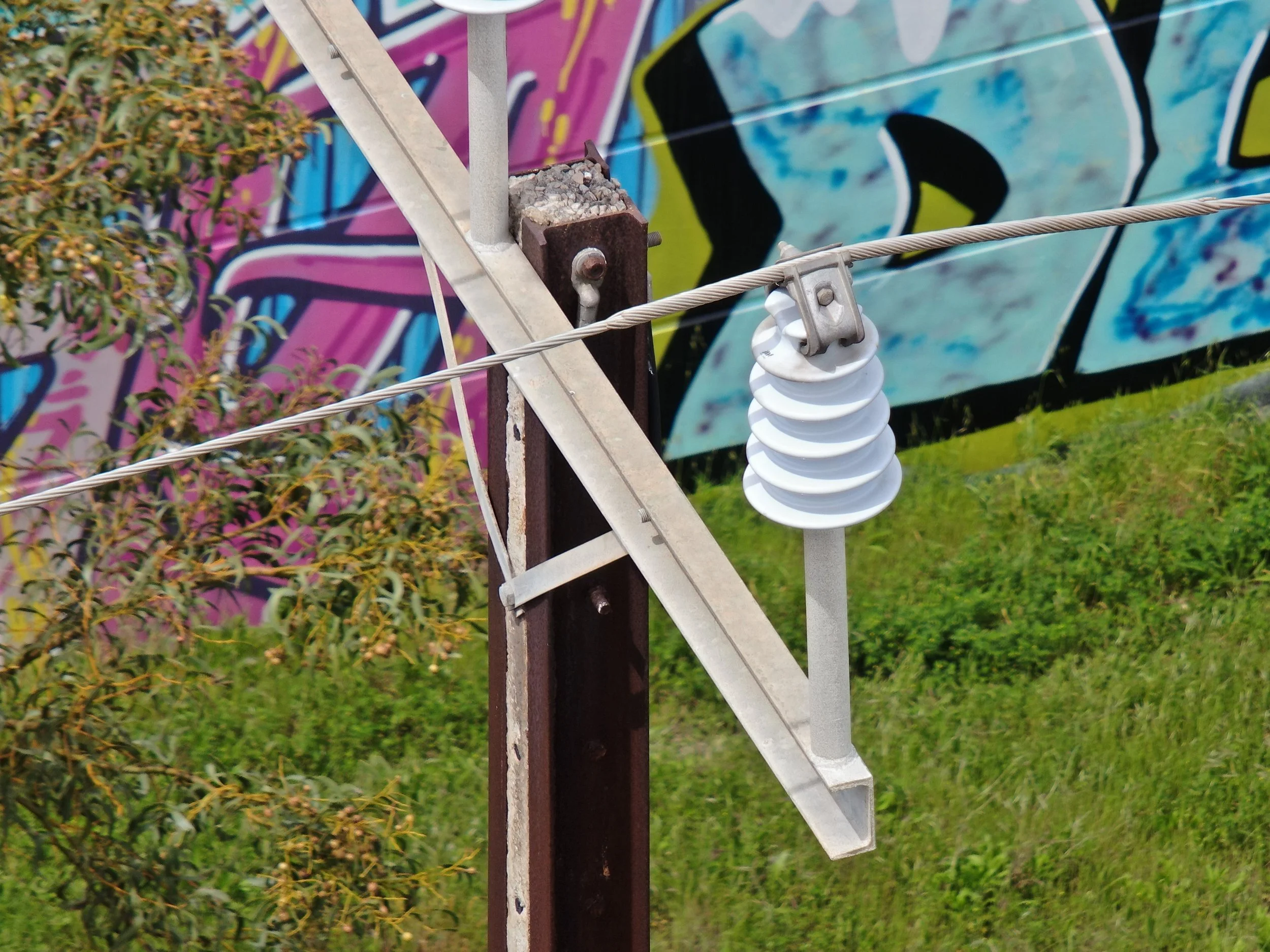
Transmission OHL Inspections
Efficient inspection of power transmission networks inclusive of lattice, poles, components, and vegetation fire risk assessment.
-
![]()
Distribution OHL Inspections
Efficient inspection of power distribution networks inclusive of poles, components, and vegetation fire risk assessment.
-
![]()
Telecom Tower Inspection
Efficient inspection of communication tower networks inclusive of lattice and pole condition, antenna audits, and line-of-sight surveys.
-
![]()
Roof and Building Inspection
Utilise drone technology to minimise access risk, reduce maintenance planning, and efficiently capture detailed roof and building condition.
-
![]()
Facade Inspection
Aerial inspection of difficult-to-access facade features including concrete, glass, weather seals, cassette, and fixings.
-
![]()
Jetty and Wharf Inspections
WSCAM-compliant inspection of difficult-to-access marine assets including jetties, wharves, ports, and bulk load export facilities.